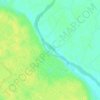
Moradabad topographic map
Click on the map to display elevation.
Moradabad
The city is rich in groundwater resources. It is at an elevation of 198 meters from sea level on the banks of the Ramganga river, which is a tributary of the Ganges. Another small river, called Gagan, flows through the city. These rivers form the main water flow system of the city, with direction of the flow north-west to south-east.
About this map

Name: Moradabad topographic map, elevation, terrain.
Location: Moradabad, Uttar Pradesh, 244001, India (28.67350 78.61329 28.99350 78.93329)
Average elevation: 198 m
Minimum elevation: 181 m
Maximum elevation: 219 m
Other topographic maps
Click on a map to view its topography, its elevation and its terrain.