
Bhola topographic map
Interactive map
Click on the map to display elevation.
About this map
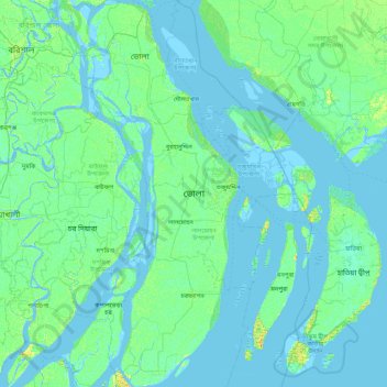
Name: Bhola topographic map, elevation, terrain.
Location: Bhola, Barishal Division, Bangladesh (21.99377 90.52436 22.80745 90.86194)
Average elevation: 3 m
Minimum elevation: -4 m
Maximum elevation: 20 m
Other topographic maps
Click on a map to view its topography, its elevation and its terrain.
Pond of Nasu Baklai
Bangladesh > Barishal Division > Borhanuddin Subdistrict > Burhanuddin
Average elevation: 5 m