
Thank you for supporting this site ❤️
Make a donation
Make a donation
Gear up for your next adventure:
As an Amazon Associate, this site earns from qualifying purchases at no extra cost to you.
Atzbach topographic map
Click on the map to display elevation.
Thank you for supporting this site ❤️
Make a donation
Make a donation
Gear up for your next adventure:
As an Amazon Associate, this site earns from qualifying purchases at no extra cost to you.
About this map
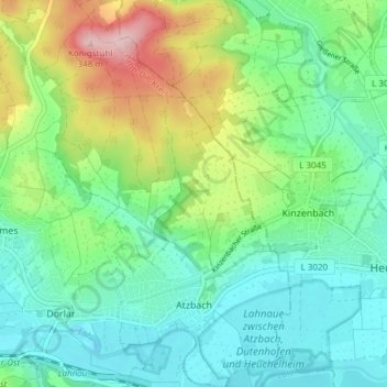
Name: Atzbach topographic map, elevation, terrain.
Location: Atzbach, Lahnau, Lahn-Dill-Kreis, Hessen, Deutschland (50.56778 8.56284 50.61565 8.60825)
Average elevation: 203 m
Minimum elevation: 145 m
Maximum elevation: 343 m
Thank you for supporting this site ❤️
Make a donation
Make a donation
Gear up for your next adventure:
As an Amazon Associate, this site earns from qualifying purchases at no extra cost to you.