
Sotenäs kommun topographic map
Interactive map
Click on the map to display elevation.
About this map
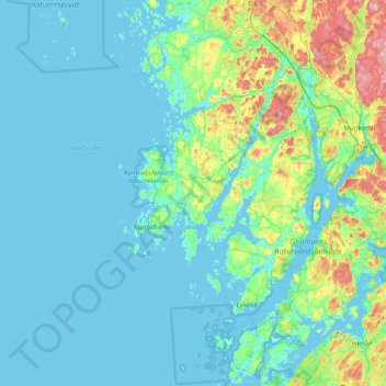
Name: Sotenäs kommun topographic map, elevation, terrain.
Location: Sotenäs kommun, Comté de Västra Götaland, Suède (58.29225 10.67544 58.50025 11.46584)
Average elevation: 24 m
Minimum elevation: -2 m
Maximum elevation: 163 m