
Sagres topographic map
Interactive map
Click on the map to display elevation.
About this map
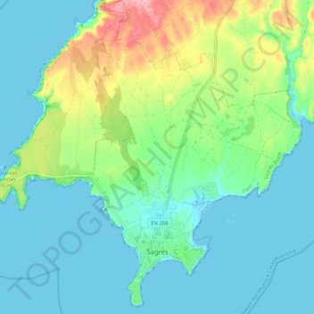
Name: Sagres topographic map, elevation, terrain.
Location: Sagres, Vila do Bispo, Faro, Portugal (36.99350 -8.99711 37.07128 -8.89475)
Average elevation: 30 m
Minimum elevation: -2 m
Maximum elevation: 126 m