Geolocate

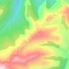
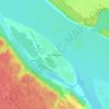
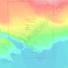
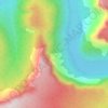
Fort Liard topographic map

Click on the map to display elevation.

About this map

Name: Fort Liard topographic map, elevation, terrain.

Location: Fort Liard, Dehcho Region, Northwest Territories, X0G 0A0, Canada (60.22218 -123.48523 60.25846 -123.37827)

Average elevation: 248 m

Minimum elevation: 192 m

Maximum elevation: 335 m

Other topographic maps

Click on a map to view its topography, its elevation and its terrain.
Inuvik

Canada > Northwest Territories

Average elevation: 159 m

Mackenzie Mountains

Canada > Northwest Territories

Average elevation: 1,213 m

North Nahanni River

Canada > Northwest Territories

Average elevation: 1,449 m

Peel River

Canada > Northwest Territories

Average elevation: 45 m

Grace Lake

Canada > Northwest Territories > Yellowknife

Average elevation: 183 m

Déline

Canada > Northwest Territories > Sahtu Region

Average elevation: 193 m

Wrigley

Canada > Northwest Territories > Dehcho Region

Average elevation: 159 m

Yellowknife

Canada > Northwest Territories > Yellowknife

Average elevation: 182 m

Gear up for your next adventure:

🏕️Camping Gear - Essential camping equipment
🦯Adjustable Trekking Poles - Reduce impact on knees when descending steep topographic ridges
🚁Camera Drones with GPS - Capture aerial views of the landscape to compare with topo maps
🧤Hiking Gloves - Protective gloves for outdoor use
🧼Biodegradable Outdoor Soap - Clean gear and yourself without harming the local ecosystem

As an Amazon Associate, this site earns from qualifying purchases at no extra cost to you.