
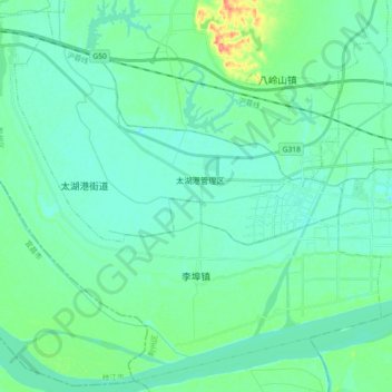
李埠镇 topographic map
Interactive map
Click on the map to display elevation.
About this map
Name: 李埠镇 topographic map, elevation, terrain.
Location: 李埠镇, 荆州区, Jingzhou, Hubei, 434000, China (30.27979 111.97075 30.42840 112.15316)
Average elevation: 37 m
Minimum elevation: 25 m
Maximum elevation: 90 m