
宁江区 topographic map
Interactive map
Click on the map to display elevation.
About this map
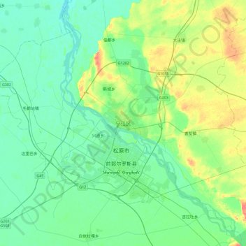
Name: 宁江区 topographic map, elevation, terrain.
Location: 宁江区, 松原市, 吉林省, 中国 (45.01357 124.66068 45.33357 124.98068)
Average elevation: 141 m
Minimum elevation: 126 m
Maximum elevation: 185 m
Other topographic maps
Click on a map to view its topography, its elevation and its terrain.