
Florina topographic map
Interactive map
Click on the map to display elevation.
Florina
Florina is one of the coldest towns in Greece, because of its elevation and geographic position. Snowfalls, sometimes heavy, thick fog and below-freezing temperatures are common during the winter months, while the summers are warm to hot. Under the Köppen climate classification, Florina has a humid subtropical climate (Cfa), bordering on a humid continental climate (Dfa).
About this map
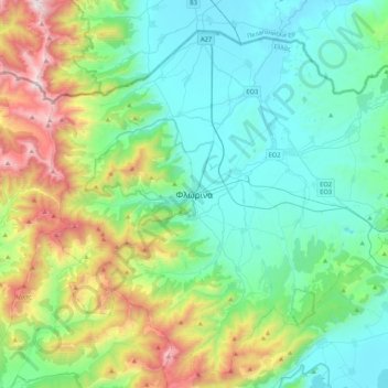
Name: Florina topographic map, elevation, terrain.
Average elevation: 999 m
Minimum elevation: 574 m
Maximum elevation: 2,319 m