
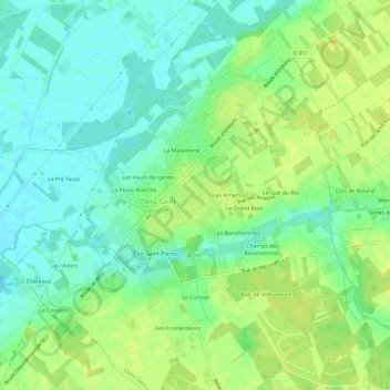
Les Grands Bonshommes topographic map
Interactive map
Click on the map to display elevation.
About this map
Name: Les Grands Bonshommes topographic map, elevation, terrain.
Average elevation: 95 m
Minimum elevation: 86 m
Maximum elevation: 103 m
Other topographic maps
Click on a map to view its topography, its elevation and its terrain.
Les Hauts Bergerets
France > Centre-Val de Loire > Loiret > Cléry-Saint-André
Les Hauts Bergerets, Cléry-Saint-André, Orléans, Loiret, Centre-Val de Loire, France métropolitaine, 45370, France
Average elevation: 93 m
La Poule Blanche
France > Centre-Val de Loire > Loiret > Cléry-Saint-André
La Poule Blanche, Cléry-Saint-André, Orléans, Loiret, Centre-Val de Loire, France métropolitaine, 45370, France
Average elevation: 93 m