Geolocate

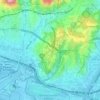
Arenzano topographic map

Click on the map to display elevation.

About this map

Name: Arenzano topographic map, elevation, terrain.

Location: Arenzano, Genoa, Liguria, 16011, Italy (44.39010 8.62342 44.45095 8.70853)

Average elevation: 335 m

Minimum elevation: 0 m

Maximum elevation: 1,176 m

Other topographic maps

Click on a map to view its topography, its elevation and its terrain.
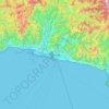
Genoa

Italy > Liguria > Genoa > Genoa

The city of Genoa covers an area of 243 square kilometres (94 sq mi) between the Ligurian Sea and the Apennine Mountains. The city stretches along the coast for about 30 kilometres (19 mi) from the neighbourhood of Voltri to Nervi, and for 10 kilometres (6.2 mi) from the coast to the north along the valleys…

Average elevation: 247 m

Ligurian Apennines

Italy > Liguria > Genoa > Rezzoaglio

Average elevation: 1,187 m

Erzelli

Italy > Liguria > Genoa > Genoa

Average elevation: 52 m

Colla di Praglia

Italy > Liguria > Genoa > Ceranesi

Average elevation: 770 m

Lago Riane

Italy > Liguria > Genoa > Santo Stefano d'Aveto

Average elevation: 1,333 m

Ferriera

Italy > Liguria > Genoa > Arenzano

Average elevation: 47 m

Gear up for your next adventure:

🔪Outdoor Multi-tools - Versatile tools for gear repair and survival tasks in the wilderness
⌚Altimeter Barometer Watches - Outdoor watches with built-in sensors to track altitude changes and weather shifts
🍶Collapsible Water Bottles - Save space in your pack as you consume your water supply
🐍Australian Snake Bite Kits - Specific pressure immobilization bandages for Australian venomous snakes
🧦Hiking Socks - Comfortable socks for long hikes

As an Amazon Associate, this site earns from qualifying purchases at no extra cost to you.