
İskele Mahallesi topographic map
Interactive map
Click on the map to display elevation.
About this map
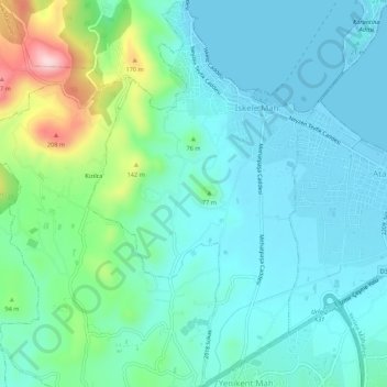
Name: İskele Mahallesi topographic map, elevation, terrain.
Location: İskele Mahallesi, Urla, Izmir, Aegean Region, Turkey (38.33277 26.74743 38.37508 26.77914)
Average elevation: 55 m
Minimum elevation: -3 m
Maximum elevation: 262 m
Other topographic maps
Click on a map to view its topography, its elevation and its terrain.
Gülbahçe Mahallesi
Gülbahçe Mahallesi, Urla, Izmir, Aegean Region, 35433, Turkey
Average elevation: 93 m