
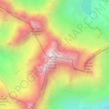
Pics de la Font Sancte topographic map
Interactive map
Click on the map to display elevation.
About this map
Name: Pics de la Font Sancte topographic map, elevation, terrain.
Average elevation: 2,814 m
Minimum elevation: 2,233 m
Maximum elevation: 3,362 m
Other topographic maps
Click on a map to view its topography, its elevation and its terrain.
Lac des Rouites
France > Provence-Alpes-Côte d'Azur > Ceillac
Lac des Rouites, Sainte-Anne, Saint-Claude, Ceillac, Briançon, Hautes-Alpes, Provence-Alpes-Côte d'Azur, France métropolitaine, 05600, France
Average elevation: 2,550 m
Lac de Clausis
France > Provence-Alpes-Côte d'Azur > Ceillac
Lac de Clausis, D 60, Saint-Claude, Ceillac, Briançon, Hautes-Alpes, Provence-Alpes-Côte d'Azur, France métropolitaine, 05600, France
Average elevation: 2,580 m