
Bük topographic map
Interactive map
Click on the map to display elevation.
About this map
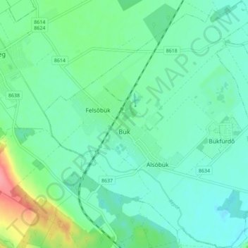
Name: Bük topographic map, elevation, terrain.
Average elevation: 179 m
Minimum elevation: 160 m
Maximum elevation: 241 m
Other topographic maps
Click on a map to view its topography, its elevation and its terrain.
Őriszentpéter
Őriszentpéter, Körmendi járás, Vas vármegye, Transdanubie, 9941, Hongrie
Average elevation: 252 m
Bögöt
Bögöt, Sárvári járás, Vas vármegye, Transdanubie, 9612, Hongrie
Average elevation: 173 m