
Sabiñán topographic map
Interactive map
Click on the map to display elevation.
About this map
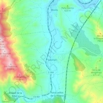
Name: Sabiñán topographic map, elevation, terrain.
Location: Sabiñán, Comunidad de Calatayud, Zaragoza, Aragón, Spanje (41.43351 -1.59922 41.46362 -1.51712)
Average elevation: 603 m
Minimum elevation: 417 m
Maximum elevation: 1,129 m
Other topographic maps
Click on a map to view its topography, its elevation and its terrain.
Mara
Spanje > Aragón > Comunidad de Calatayud
Mara, Comunidad de Calatayud, Zaragoza, Aragón, Spanje
Average elevation: 773 m