
Red Bank topographic map
Click on the map to display elevation.
About this map
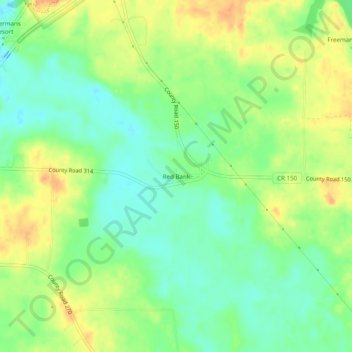
Name: Red Bank topographic map, elevation, terrain.
Location: Red Bank, Lawrence County, Alabama, United States (34.74731 -87.39002 34.78731 -87.35002)
Average elevation: 173 m
Minimum elevation: 155 m
Maximum elevation: 192 m