
西丽街道 topographic map
Interactive map
Click on the map to display elevation.
About this map
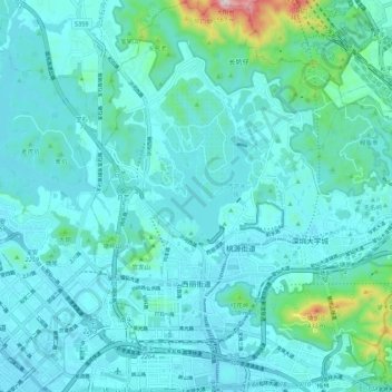
Name: 西丽街道 topographic map, elevation, terrain.
Location: 西丽街道, 南山区, 深圳市, 广东省, 518000, 中国 (22.55508 113.91719 22.65542 113.98848)
Average elevation: 67 m
Minimum elevation: -4 m
Maximum elevation: 557 m
Other topographic maps
Click on a map to view its topography, its elevation and its terrain.