
Hammond topographic map
Interactive map
Click on the map to display elevation.
About this map
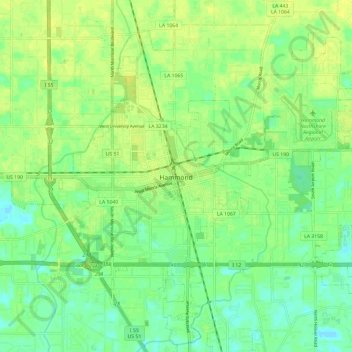
Name: Hammond topographic map, elevation, terrain.
Average elevation: 13 m
Minimum elevation: 3 m
Maximum elevation: 20 m
Hammond is located at 30°30′16″N 90°27′56″W / 30.50444°N 90.46556°W / 30.50444; -90.46556 (30.504446, -90.465616) and has an elevation of 43 feet (13.1 m).