
Thank you for supporting this site ❤️
Make a donation
Make a donation
Gear up for your next adventure:
As an Amazon Associate, this site earns from qualifying purchases at no extra cost to you.
Gainesville topographic map
Click on the map to display elevation.
Thank you for supporting this site ❤️
Make a donation
Make a donation
Gear up for your next adventure:
🧭Global Orienteering Compass - High-precision liquid-filled compasses for accurate map reading and navigation
As an Amazon Associate, this site earns from qualifying purchases at no extra cost to you.
About this map
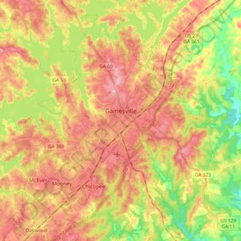
Name: Gainesville topographic map, elevation, terrain.
Location: Gainesville, Hall County, Georgia, 30501, United States (34.22117 -83.89959 34.36290 -83.75569)
Average elevation: 346 m
Minimum elevation: 266 m
Maximum elevation: 410 m
Thank you for supporting this site ❤️
Make a donation
Make a donation
Gear up for your next adventure:
As an Amazon Associate, this site earns from qualifying purchases at no extra cost to you.