Geolocate
👉 Easily get elevation data in JSON, GeoTIFF and KML formats using Elevation API
Thank you for supporting this site ❤️
Make a donation

Keswick topographic map

Click on the map to display elevation.

About this map

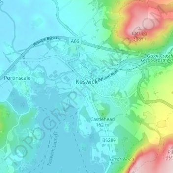
Name: Keswick topographic map, elevation, terrain.

Location: Keswick, Cumberland, England, United Kingdom (54.58732 -3.16352 54.61249 -3.09942)

Average elevation: 128 m

Minimum elevation: 71 m

Maximum elevation: 369 m

Other topographic maps

Click on a map to view its topography, its elevation and its terrain.

How Mill

United Kingdom > England > Cumberland

Average elevation: 90 m

Gear up for your next adventure:

🧥Down Jackets - Insulated jackets for cold weather
🧥Packable Rain Jackets - Breathable waterproof layers for unpredictable mountain weather
🧭Compass - Navigation compasses for outdoor exploration
🐍Snake Gaiters - Protection against snake bites
🦶Orthotic Hiking Insoles - Extra arch support for long-distance topographic treks

As an Amazon Associate, this site earns from qualifying purchases at no extra cost to you.