
Rawa County topographic map
Interactive map
Click on the map to display elevation.
About this map
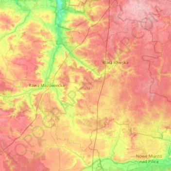
Name: Rawa County topographic map, elevation, terrain.
Location: Rawa County, Łódzkie Voivodship, Poland (51.63206 20.11153 51.89225 20.65926)
Average elevation: 167 m
Minimum elevation: 109 m
Maximum elevation: 213 m
Other topographic maps
Click on a map to view its topography, its elevation and its terrain.