Geolocate

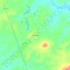
Gilmer topographic map

Click on the map to display elevation.

About this map

Name: Gilmer topographic map, elevation, terrain.

Location: Gilmer, Upshur County, Texas, United States (32.69083 -94.96785 32.75907 -94.92056)

Average elevation: 116 m

Minimum elevation: 81 m

Maximum elevation: 197 m

Other topographic maps

Click on a map to view its topography, its elevation and its terrain.

Rhonesboro

United States > Texas > Upshur County

Average elevation: 155 m

Bettie

United States > Texas > Upshur County

Average elevation: 100 m

Diana

United States > Texas > Upshur County

Average elevation: 95 m

Bethel

United States > Texas > Upshur County

Average elevation: 88 m

Diana

United States > Texas > Upshur County

Average elevation: 95 m

Pattonfield

United States > Texas > Upshur County

Average elevation: 121 m

Gear up for your next adventure:

📣High-Decibel Survival Whistles - Signaling tool for rescue that carries much further than a human voice
🧥Thermal Emergency Blankets - Compact Mylar blankets to prevent hypothermia if stranded overnight
🧰Survival Kits - Essential survival gear
🌧️Rain Jackets - Waterproof jackets for hiking
🐍Snake Gaiters - Protection against snake bites

As an Amazon Associate, this site earns from qualifying purchases at no extra cost to you.