Bad Ditzenbach topographic map
Click on the map to display elevation.
Bad Ditzenbach
The municipality (Gemeinde) of Bad Ditzenbach is situated in the district of Göppingen, of the German state of Baden-Württemberg. Bad Ditzenbach lies along Göppingen's district border with the Alb-Danube district to the south. The municipal area is physically located in the Middle Kuppenalb [de]. Elevation above sea level in the municipality ranges from a high of 777 meters (2,549 ft) Normalnull (NN) to a low of 465 meters (1,526 ft) NN along the Fils.
About this map
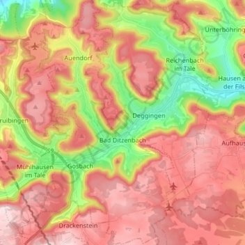
Name: Bad Ditzenbach topographic map, elevation, terrain.
Average elevation: 659 m
Minimum elevation: 444 m
Maximum elevation: 822 m
Other topographic maps
Click on a map to view its topography, its elevation and its terrain.