
Thank you for supporting this site ❤️
Make a donation
Make a donation
Gear up for your next adventure:
As an Amazon Associate, this site earns from qualifying purchases at no extra cost to you.
Ciamber topographic map
Click on the map to display elevation.
Thank you for supporting this site ❤️
Make a donation
Make a donation
Gear up for your next adventure:
As an Amazon Associate, this site earns from qualifying purchases at no extra cost to you.
About this map
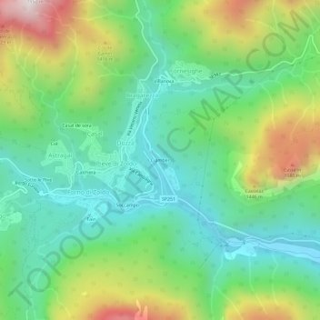
Name: Ciamber topographic map, elevation, terrain.
Location: Ciamber, Dozza, Val di Zoldo, Belluno, Vénétie, 32012, Italie (46.33060 12.17012 46.37060 12.21012)
Average elevation: 1,126 m
Minimum elevation: 779 m
Maximum elevation: 1,840 m
Thank you for supporting this site ❤️
Make a donation
Make a donation
Gear up for your next adventure:
As an Amazon Associate, this site earns from qualifying purchases at no extra cost to you.