
Castigues topographic map
Interactive map
Click on the map to display elevation.
About this map
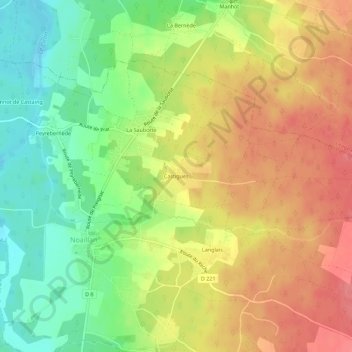
Name: Castigues topographic map, elevation, terrain.
Average elevation: 52 m
Minimum elevation: 15 m
Maximum elevation: 85 m
Other topographic maps
Click on a map to view its topography, its elevation and its terrain.
Arroutgey Sud
France > Nouvelle-Aquitaine > Gironde > Noaillan
Arroutgey Sud, Noaillan, Langon, Gironde, Nouvelle-Aquitaine, France métropolitaine, 33730, France
Average elevation: 56 m