
Thank you for supporting this site ❤️
Make a donation
Make a donation
Gear up for your next adventure:
As an Amazon Associate, this site earns from qualifying purchases at no extra cost to you.
Shahkot topographic map
Click on the map to display elevation.
Thank you for supporting this site ❤️
Make a donation
Make a donation
Gear up for your next adventure:
As an Amazon Associate, this site earns from qualifying purchases at no extra cost to you.
About this map
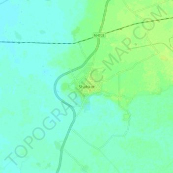
Name: Shahkot topographic map, elevation, terrain.
Location: Shahkot, Shahkot Tahsil, Jalandhar, Punjab, 144702, India (31.04311 75.29667 31.12311 75.37667)
Average elevation: 223 m
Minimum elevation: 218 m
Maximum elevation: 231 m
Thank you for supporting this site ❤️
Make a donation
Make a donation
Gear up for your next adventure:
As an Amazon Associate, this site earns from qualifying purchases at no extra cost to you.