
Þingeyjarsveit topographic map
Interactive map
Click on the map to display elevation.
About this map
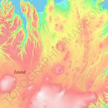
Name: Þingeyjarsveit topographic map, elevation, terrain.
Location: Þingeyjarsveit, Northeastern Region, Iceland (64.40930 -18.30255 66.17243 -16.00546)
Average elevation: 663 m
Minimum elevation: -5 m
Maximum elevation: 2,000 m
Other topographic maps
Click on a map to view its topography, its elevation and its terrain.