Geolocate

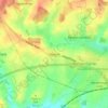
Shipton Bellinger topographic map

Click on the map to display elevation.

About this map

Name: Shipton Bellinger topographic map, elevation, terrain.

Location: Shipton Bellinger, Test Valley, Hampshire, England, United Kingdom (51.19058 -1.69412 51.22047 -1.61703)

Average elevation: 126 m

Minimum elevation: 87 m

Maximum elevation: 191 m

Other topographic maps

Click on a map to view its topography, its elevation and its terrain.

Anna Valley

United Kingdom > England > Hampshire > Test Valley

Average elevation: 73 m

Gosport

United Kingdom > England > Hampshire > Test Valley > Ampfield

Average elevation: 46 m

Danebury Hill

United Kingdom > England > Hampshire > Test Valley

Average elevation: 89 m

Michelmersh

United Kingdom > England > Hampshire > Test Valley

Average elevation: 49 m

Dunbridge

United Kingdom > England > Hampshire > Test Valley > Mottisfont

Average elevation: 43 m

Kent's Oak

United Kingdom > England > Hampshire > Test Valley > Awbridge

Average elevation: 49 m

Test

United Kingdom > England > Hampshire > Test Valley > Chilbolton

Average elevation: 60 m

Horseshoe Hill

United Kingdom > England > Hampshire > Test Valley

Average elevation: 106 m

Faberstown

United Kingdom > England > Hampshire > Test Valley > Faberstown

Average elevation: 124 m

Barrow Hill

United Kingdom > England > Hampshire > Test Valley

Average elevation: 66 m

Andover

United Kingdom > England > Hampshire > Test Valley > Upper Enham

Average elevation: 88 m

Palestine

United Kingdom > England > Hampshire > Test Valley > Palestine

Average elevation: 109 m

Clanville

United Kingdom > England > Hampshire > Test Valley > Appleshaw

Average elevation: 107 m

Thruxton Down

United Kingdom > England > Hampshire > Test Valley

Average elevation: 113 m

Vernham Street

United Kingdom > England > Hampshire > Test Valley

Average elevation: 178 m

Picket Piece

United Kingdom > England > Hampshire > Test Valley

Average elevation: 97 m

Hatherden

United Kingdom > England > Hampshire > Test Valley

Average elevation: 125 m

Upper Enham

United Kingdom > England > Hampshire > Test Valley

Average elevation: 120 m

Sandy Down

United Kingdom > England > Hampshire > Test Valley

Average elevation: 94 m

Fullerton

United Kingdom > England > Hampshire > Test Valley > Chilbolton

Average elevation: 64 m

Rownhams

United Kingdom > England > Hampshire > Test Valley

Average elevation: 33 m

East Wellow

United Kingdom > England > Hampshire > Test Valley > Wellow

Average elevation: 35 m

Timsbury

United Kingdom > England > Hampshire > Test Valley

Average elevation: 42 m

Hollom Down

United Kingdom > England > Hampshire > Test Valley

Average elevation: 107 m

Canada Common

United Kingdom > England > Hampshire > Test Valley > Wellow > Canada

Average elevation: 39 m

Ibthorpe

United Kingdom > England > Hampshire > Test Valley

Average elevation: 147 m

L24

United Kingdom > England > Hampshire > Test Valley > Leckford

Average elevation: 85 m

Test Valley

United Kingdom > England > Hampshire > Test Valley

Average elevation: 64 m

Pucknall

United Kingdom > England > Hampshire > Test Valley > Braishfield

Average elevation: 61 m

Chattis Hill

United Kingdom > England > Hampshire > Test Valley

Average elevation: 76 m

Upton

United Kingdom > England > Hampshire > Test Valley

Average elevation: 162 m

Weyhill

United Kingdom > England > Hampshire > Test Valley

Average elevation: 87 m

Gear up for your next adventure:

📟Satellite Messengers - Two-way satellite communication to stay in touch beyond the cellular grid
🩹Wilderness First Aid Kits - Comprehensive medical kits tailored for hiking and remote exploration
🕶️Polarized Outdoor Sunglasses - Reduce glare from rocks and water for better visual navigation
🔥Ferrocerium Rod Fire Starters - Reliable fire lighting in wet or windy conditions without matches
🧊Insulated Stainless Steel Flasks - Keep water cold for 24 hours in the heat or coffee hot in the cold

As an Amazon Associate, this site earns from qualifying purchases at no extra cost to you.