
Lubin topographic map
Interactive map
Click on the map to display elevation.
About this map
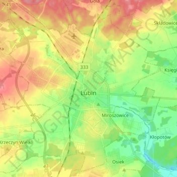
Name: Lubin topographic map, elevation, terrain.
Location: Lubin, powiat lubiński, Basse-Silésie, Pologne (51.35897 16.12963 51.43987 16.25825)
Average elevation: 140 m
Minimum elevation: 105 m
Maximum elevation: 179 m
Other topographic maps
Click on a map to view its topography, its elevation and its terrain.
Lubin
Pologne > Basse-Silésie > powiat lubiński > Lubin
Lubin, powiat lubiński, Basse-Silésie, Pologne
Average elevation: 141 m