
Thank you for supporting this site ❤️
Make a donation
Make a donation
Gear up for your next adventure:
As an Amazon Associate, this site earns from qualifying purchases at no extra cost to you.
Levadas topographic map
Click on the map to display elevation.
Thank you for supporting this site ❤️
Make a donation
Make a donation
Gear up for your next adventure:
As an Amazon Associate, this site earns from qualifying purchases at no extra cost to you.
About this map
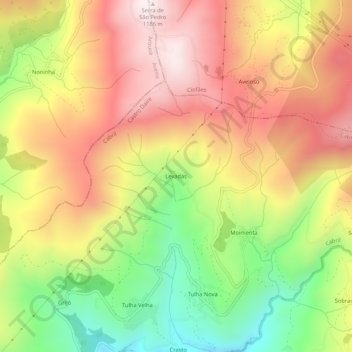
Name: Levadas topographic map, elevation, terrain.
Location: Levadas, Cabril, Castro Daire, Viseu, 4690-761, Portugal (40.95667 -8.10750 40.99667 -8.06750)
Average elevation: 813 m
Minimum elevation: 398 m
Maximum elevation: 1,180 m
Thank you for supporting this site ❤️
Make a donation
Make a donation
Gear up for your next adventure:
As an Amazon Associate, this site earns from qualifying purchases at no extra cost to you.