
Barstow topographic map
Click on the map to display elevation.
About this map
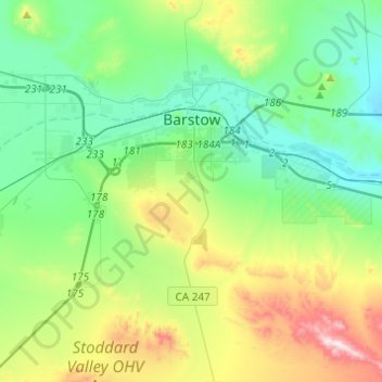
Name: Barstow topographic map, elevation, terrain.
Location: Barstow, San Bernardino County, California, United States (34.80448 -117.15338 34.91795 -116.90916)
Average elevation: 771 m
Minimum elevation: 598 m
Maximum elevation: 1,233 m
Other topographic maps
Click on a map to view its topography, its elevation and its terrain.
Sam Alba Memorial Park
United States > California > San Bernardino County > Ontario
Average elevation: 296 m