Geolocate

Bianmen topographic map

Click on the map to display elevation.

About this map

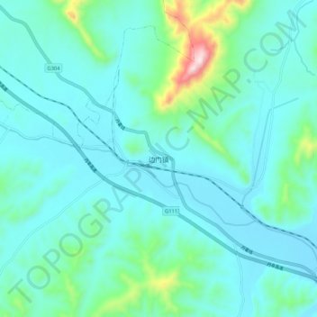
Name: Bianmen topographic map, elevation, terrain.

Location: Bianmen, Fengcheng City, Dandong City, Liaoning, China (40.30919 124.05470 40.38919 124.13470)

Average elevation: 143 m

Minimum elevation: 52 m

Maximum elevation: 656 m

Other topographic maps

Click on a map to view its topography, its elevation and its terrain.

Gear up for your next adventure:

🪢Paracord - Multi-purpose survival cord
🎧Bluetooth Outdoor Earbuds - Listen to navigation cues or podcasts during long solo treks
🧢Outdoor Sun Hats - Sun protection hats for hiking
🛌Sleeping Mats - Insulated mats for camping comfort
🩹First Aid Kits - Emergency kits for hiking

As an Amazon Associate, this site earns from qualifying purchases at no extra cost to you.