Geolocate

Manduria topographic map

Click on the map to display elevation.

About this map
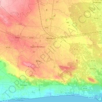
Name: Manduria topographic map, elevation, terrain.

Location: Manduria, Taranto, Apulia, 74024, Italy (40.29458 17.54255 40.46541 17.77055)

Average elevation: 70 m

Minimum elevation: -2 m

Maximum elevation: 139 m

Other topographic maps

Click on a map to view its topography, its elevation and its terrain.

Torre Colimena

Italy > Apulia > Taranto > Manduria

Average elevation: 3 m

Chiatona

Italy > Apulia > Taranto > Palagiano

Average elevation: 5 m

Gear up for your next adventure:

🧺Waterproof Dry Sacks - Organize your pack and keep electronics safe from rain and river crossings
🎒3L Hydration Reservoirs - Hands-free drinking to stay hydrated on steep contour climbs
🕶️Polarized Outdoor Sunglasses - Reduce glare from rocks and water for better visual navigation
🪫Rechargeable Headlamps - USB rechargeable headlamps
🦘Outback Survival Gear - Essential gear for Australian outback

As an Amazon Associate, this site earns from qualifying purchases at no extra cost to you.