
东风镇 topographic map
Interactive map
Click on the map to display elevation.
About this map
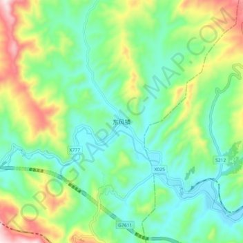
Name: 东风镇 topographic map, elevation, terrain.
Location: 东风镇, 威宁彝族回族苗族自治县, 毕节市, 贵州省, 中国 (26.76059 104.54650 26.84059 104.62650)
Average elevation: 1,941 m
Minimum elevation: 1,769 m
Maximum elevation: 2,328 m
Other topographic maps
Click on a map to view its topography, its elevation and its terrain.