
Western topographic map
Click on the map to display elevation.
About this map
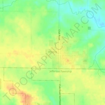
Name: Western topographic map, elevation, terrain.
Location: Western, Linn County, Iowa, United States (41.86121 -91.65131 41.86968 -91.63668)
Average elevation: 250 m
Minimum elevation: 229 m
Maximum elevation: 267 m
Other topographic maps
Click on a map to view its topography, its elevation and its terrain.
Hiawatha
United States > Iowa > Linn County > Hiawatha
The elevation of Hiawatha is 850 feet (260 m) above sea level.
Average elevation: 256 m