
Le Port topographic map
Interactive map
Click on the map to display elevation.
About this map
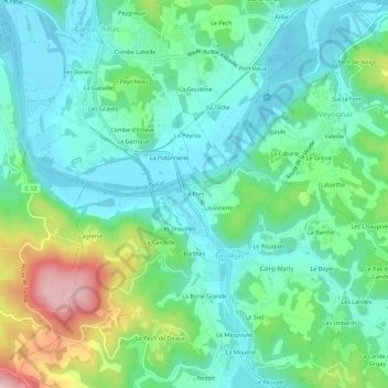
Name: Le Port topographic map, elevation, terrain.
Average elevation: 129 m
Minimum elevation: 71 m
Maximum elevation: 288 m
Other topographic maps
Click on a map to view its topography, its elevation and its terrain.
Les Treilles
France > Nouvelle-Aquitaine > Dordogne > Groléjac > Les Treilles
Les Treilles, Groléjac, Sarlat-la-Canéda, Dordogne, Nouvelle-Aquitaine, France métropolitaine, 24250, France
Average elevation: 142 m