
Maple Row Estates topographic map
Interactive map
Click on the map to display elevation.
About this map
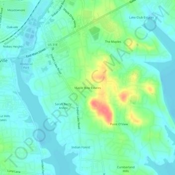
Name: Maple Row Estates topographic map, elevation, terrain.
Average elevation: 150 m
Minimum elevation: 135 m
Maximum elevation: 195 m
Other topographic maps
Click on a map to view its topography, its elevation and its terrain.
Saundersville
United States > Tennessee > Sumner County > Hendersonville
Saundersville, Hendersonville, Sumner County, Middle Tennessee, Tennessee, 30766, United States
Average elevation: 160 m
Scottish Highlands
United States > Tennessee > Sumner County > Hendersonville
Scottish Highlands, Hendersonville, Sumner County, Middle Tennessee, Tennessee, 37075, United States
Average elevation: 157 m
Highland Acres
United States > Tennessee > Sumner County > Hendersonville > Highland Acres
Highland Acres, Hendersonville, Sumner County, Tennessee, 37075, United States
Average elevation: 153 m