Geolocate

Cobar topographic map

Click on the map to display elevation.

About this map

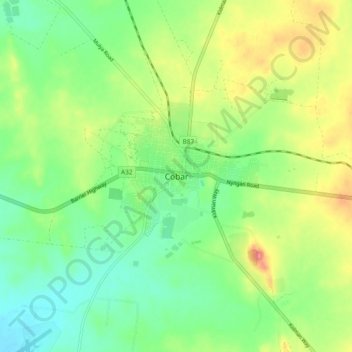
Name: Cobar topographic map, elevation, terrain.

Location: Cobar, Cobar Shire Council, New South Wales, Australia (-31.53833 145.79444 -31.45833 145.87444)

Average elevation: 246 m

Minimum elevation: 215 m

Maximum elevation: 297 m

New South Wales trails, hiking, mountain biking, running and outdoor activities

Gear up for your next adventure:

🏫Topographic World Globes - 3D physical relief globes to understand global geography
👣Snake & Scrub Gaiters - Protection against spinifex, mud, and snakes while walking off-track
🧴SPF 50+ Bulk Sunscreen - Maximum protection for long-term outdoor exposure
🪢Paracord - Multi-purpose survival cord
🔌Fast Charging Adapters - Quickly top up all your gear before heading back into the field

As an Amazon Associate, this site earns from qualifying purchases at no extra cost to you.