
Santpoort-Noord topographic map
Interactive map
Click on the map to display elevation.
About this map
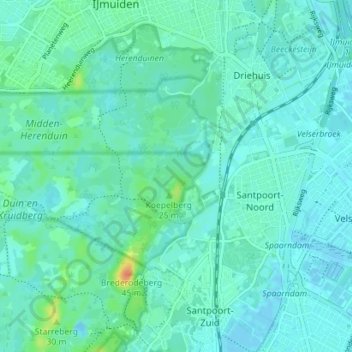
Name: Santpoort-Noord topographic map, elevation, terrain.
Location: Santpoort-Noord, Velsen, Noord-Holland, Nederland (52.42103 4.58469 52.45137 4.65519)
Average elevation: 7 m
Minimum elevation: -3 m
Maximum elevation: 39 m
Other topographic maps
Click on a map to view its topography, its elevation and its terrain.
Fort benoorden Spaarndam
Nederland > Noord-Holland > Velsen
Fort benoorden Spaarndam, Redoute, Velserbroek, Velsen, Noord-Holland, Nederland, 1981LL, Nederland
Average elevation: 1 m