
Belle Plagne topographic map
Interactive map
Click on the map to display elevation.
About this map
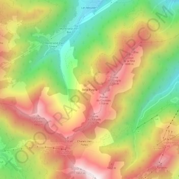
Name: Belle Plagne topographic map, elevation, terrain.
Average elevation: 1,374 m
Minimum elevation: 870 m
Maximum elevation: 1,850 m
Other topographic maps
Click on a map to view its topography, its elevation and its terrain.
Le Sey
France > Auvergne-Rhône-Alpes > Haute-Savoie > Seytroux
Le Sey, Seytroux, Thonon-les-Bains, Haute-Savoie, Auvergne-Rhône-Alpes, France métropolitaine, 74430, France
Average elevation: 1,026 m