Geolocate

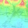
Warningcamp topographic map

Click on the map to display elevation.

About this map

Name: Warningcamp topographic map, elevation, terrain.

Location: Warningcamp, Crossbush, Arun, West Sussex, England, United Kingdom (50.84443 -0.54677 50.86380 -0.49707)

Average elevation: 17 m

Minimum elevation: -4 m

Maximum elevation: 95 m

Other topographic maps

Click on a map to view its topography, its elevation and its terrain.
Bognor Regis

United Kingdom > England > West Sussex > Arun > Nyetimber

Average elevation: 2 m

Nyetimber

United Kingdom > England > West Sussex > Arun

Average elevation: 3 m

Lidsey Rife

United Kingdom > England > West Sussex > Arun > Felpham

Average elevation: 3 m

Elmer

United Kingdom > England > West Sussex > Arun

Average elevation: 2 m

Wick

United Kingdom > England > West Sussex > Arun > Littlehampton > Lyminster

Average elevation: 3 m

Shripney

United Kingdom > England > West Sussex > Arun

Average elevation: 3 m

Fontwell

United Kingdom > England > West Sussex > Arun

Average elevation: 31 m

Eastergate

United Kingdom > England > West Sussex > Arun

Average elevation: 12 m

North Bersted

United Kingdom > England > West Sussex > Arun

Average elevation: 3 m

Binsted

United Kingdom > England > West Sussex > Arun > Walberton

Average elevation: 23 m

Eastergate

United Kingdom > England > West Sussex > Arun

Average elevation: 12 m

Barnham

United Kingdom > England > West Sussex > Arun

Average elevation: 6 m

Gear up for your next adventure:

🐍Australian Snake Bite Kits - Specific pressure immobilization bandages for Australian venomous snakes
🧼Biodegradable Soap - Eco-friendly outdoor soap
Ultralight Solo Tents - Compact shelters for multi-day topographic surveying expeditions
📚Map Reading & Navigation Guides - Master the art of interpreting topographic contours and symbols
🔦Powerful LED Headlamps - Hands-free lighting for night navigation and setting up camp after dark

As an Amazon Associate, this site earns from qualifying purchases at no extra cost to you.