Geolocate

Buckden topographic map

Click on the map to display elevation.

About this map
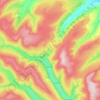
Name: Buckden topographic map, elevation, terrain.

Location: Buckden, Craven District, North Yorkshire, England, United Kingdom (54.17155 -2.28446 54.25217 -2.05932)

Average elevation: 441 m

Minimum elevation: 151 m

Maximum elevation: 704 m

Other topographic maps

Click on a map to view its topography, its elevation and its terrain.

Gear up for your next adventure:

🍳Camping Cookware - Cookware sets for outdoor meals
🚁Camera Drones with GPS - Capture aerial views of the landscape to compare with topo maps
📡Weather Radios - Emergency weather radios
🛰️Handheld GPS Units - Rugged GPS devices for tracking coordinates and elevation in the Australian bush
🔦Powerful LED Headlamps - Hands-free lighting for night navigation and setting up camp after dark

As an Amazon Associate, this site earns from qualifying purchases at no extra cost to you.