Geolocate

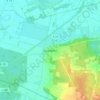
Gusborn topographic map

Click on the map to display elevation.

About this map

Name: Gusborn topographic map, elevation, terrain.

Location: Gusborn, Samtgemeinde Elbtalaue, Landkreis Lüchow-Dannenberg, Lower Saxony, 29476, Germany (53.02645 11.14379 53.14457 11.25025)

Average elevation: 17 m

Minimum elevation: 9 m

Maximum elevation: 51 m

Other topographic maps

Click on a map to view its topography, its elevation and its terrain.
Gear up for your next adventure:

🧴SPF 50+ Bulk Sunscreen - Maximum protection for long-term outdoor exposure
👄SPF Lip Balm - Prevent sun and wind-burnt lips on mountain ridges
⛺Ultralight Solo Tents - Compact shelters for multi-day topographic surveying expeditions
💡Collapsible Camping Lanterns - Illuminate your base camp or tent for map studying at night
🍳Camping Cookware - Cookware sets for outdoor meals

As an Amazon Associate, this site earns from qualifying purchases at no extra cost to you.