Geolocate

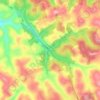
Tazewell topographic map

Click on the map to display elevation.

About this map

Name: Tazewell topographic map, elevation, terrain.

Location: Tazewell, Claiborne County, East Tennessee, Tennessee, 37824, United States (36.43122 -83.59363 36.49202 -83.52592)

Average elevation: 458 m

Minimum elevation: 332 m

Maximum elevation: 591 m

Other topographic maps

Click on a map to view its topography, its elevation and its terrain.
Speedwell

United States > Tennessee > Claiborne County

Average elevation: 416 m

Tazewell

United States > Tennessee > Claiborne County > Tazewell

Average elevation: 453 m

Speedwell

United States > Tennessee > Claiborne County

Average elevation: 416 m

Bacchus

United States > Tennessee > Claiborne County

Average elevation: 461 m

Speedwell

United States > Tennessee > Claiborne County

Average elevation: 416 m

Gear up for your next adventure:

🪑Portable Backpacking Chairs - A comfortable seat for studying maps at the end of the day
🏕️Camping Gear - Essential camping equipment
🧰Survival Kits - Essential survival gear
📱Tablet Tripod Mounts - Steady platforms for viewing digital maps or taking long exposures
🧥Down Jackets - Insulated jackets for cold weather

As an Amazon Associate, this site earns from qualifying purchases at no extra cost to you.