Geolocate

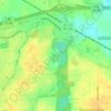
Landmarks topographic map

Click on the map to display elevation.

About this map

Name: Landmarks topographic map, elevation, terrain.

Location: Landmarks, Montgomery, Montgomery County, Alabama, 36119, United States (32.35847 -86.21441 32.39847 -86.17441)

Average elevation: 72 m

Minimum elevation: 49 m

Maximum elevation: 92 m

Other topographic maps

Click on a map to view its topography, its elevation and its terrain.
Gear up for your next adventure:

🧭Military Style Lensatic Compass - Durable sighting compasses for advanced land navigation and surveying
🦶Orthotic Hiking Insoles - Extra arch support for long-distance topographic treks
🥤Outdoor Water Bottles - Reusable bottles for outdoor activities
🔥Camping Stoves - Portable stoves for outdoor cooking
🎒3L Hydration Reservoirs - Hands-free drinking to stay hydrated on steep contour climbs

As an Amazon Associate, this site earns from qualifying purchases at no extra cost to you.