
Bialystok topographic map
Interactive map
Click on the map to display elevation.
About this map
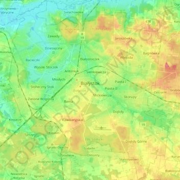
Name: Bialystok topographic map, elevation, terrain.
Location: Bialystok, Woiwodschaft Podlachien, Polen (53.06660 23.06579 53.18860 23.24719)
Average elevation: 142 m
Minimum elevation: 110 m
Maximum elevation: 190 m