
Lac de Saint-Andéol topographic map
Interactive map
Click on the map to display elevation.
About this map
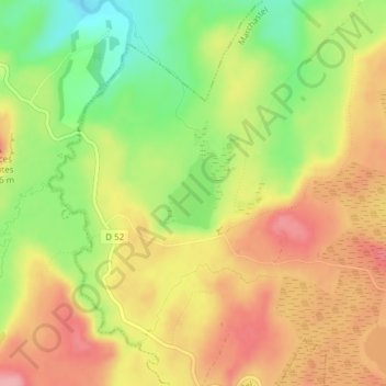
Name: Lac de Saint-Andéol topographic map, elevation, terrain.
Average elevation: 1,237 m
Minimum elevation: 1,174 m
Maximum elevation: 1,289 m
Other topographic maps
Click on a map to view its topography, its elevation and its terrain.
Rieutort d'Aubrac
France > Occitanie > Lozère > Marchastel
Rieutort d'Aubrac, Marchastel, Mende, Lozère, Occitanie, France métropolitaine, 48260, France
Average elevation: 1,190 m