
Han topographic map
Interactive map
Click on the map to display elevation.
About this map
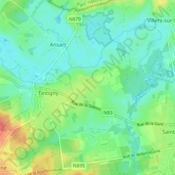
Name: Han topographic map, elevation, terrain.
Location: Han, Tintigny, Virton, Luxemburg, Wallonië, 6730, België (49.66329 5.51244 49.70329 5.55244)
Average elevation: 341 m
Minimum elevation: 323 m
Maximum elevation: 381 m