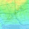
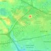
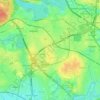
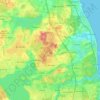
Glostrup topographic map
Click on the map to display elevation.
About this map

Name: Glostrup topographic map, elevation, terrain.
Average elevation: 15 m
Minimum elevation: -2 m
Maximum elevation: 61 m
Other topographic maps
Click on a map to view its topography, its elevation and its terrain.
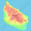
Bornholm
Denmark > Capital Region of Denmark
The island is known as solskinsøen ("sunshine island") because of its weather and klippeøen ("rock island") because of its geology, which consists of granite, except along the southern coast. The heat from the summer is stored in the rock formations and the weather is quite warm until October. As a result of…
Average elevation: 33 m



Bornholm
Denmark > Capital Region of Denmark
The island is known as solskinsøen ("sunshine island") because of its weather and klippeøen ("rock island") because of its geology, which consists of granite, except along the southern coast. The heat from the summer is stored in the rock formations and the weather is quite warm until October. As a result of…
Average elevation: 33 m
Bornholm
Denmark > Capital Region of Denmark
The island is known as solskinsøen ("sunshine island") because of its weather and klippeøen ("rock island") because of its geology, which consists of granite, except along the southern coast. The heat from the summer is stored in the rock formations and the weather is quite warm until October. As a result of…
Average elevation: 33 m
Bornholm
Denmark > Capital Region of Denmark
The island is known as solskinsøen ("sunshine island") because of its weather and klippeøen ("rock island") because of its geology, which consists of granite, except along the southern coast. The heat from the summer is stored in the rock formations and the weather is quite warm until October. As a result of…
Average elevation: 33 m