Geolocate

Lac Cardinal topographic map

Click on the map to display elevation.

About this map
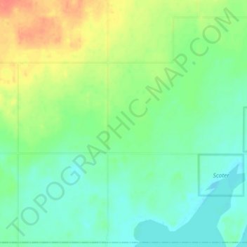
Name: Lac Cardinal topographic map, elevation, terrain.

Location: Lac Cardinal, Division No. 17, Alberta, Canada (56.24667 -117.83667 56.28667 -117.79667)

Average elevation: 655 m

Minimum elevation: 639 m

Maximum elevation: 682 m

Other topographic maps

Click on a map to view its topography, its elevation and its terrain.

Lesser Slave Lake

Canada > Alberta > Division No. 17

Average elevation: 705 m

Gear up for your next adventure:

🧯Animal Deterrent Spray - Safety spray for wildlife
🔌Fast Charging Adapters - Quickly top up all your gear before heading back into the field
🎒3L Hydration Reservoirs - Hands-free drinking to stay hydrated on steep contour climbs
🥾Trail Running Shoes - Shoes for trail running
🎒Hiking Backpacks - Backpacks designed for hiking and trekking

As an Amazon Associate, this site earns from qualifying purchases at no extra cost to you.